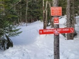
The Gabrielle-Roy-Ouest Trail is an 11.4-km linear footpath that is part of a major project being developed by the Charlevoix MRC. The project involves linking the Sentier des Caps to the Traversée de Charlevoix by means of a footpath.
The intermediate trail is accessible by hiking in summer and snowshoeing in winter. It begins near the Liguori refuge to the west and ends at the FIEF residential development to the east. The winding, mountainous route winds through the forest, crossing wetlands, streams and rivers. It offers numerous views of the river and Le Massif de Charlevoix.
East access
From Route 138, take Chemin du Fief and, after the bridge over the Rivière du Sault, turn right onto Rue de l’Étendard. Parking, a rest area and an information shelter are just a few metres away, and the trailhead is at the end of the street.
South access
From Route 138, take Rue Principale down to the village, then cross it to Domaine à Liguori. Near the information shelter, take the L’Ancestrale trail for 3.2 km to reach the Gabrielle-Roy-Ouest scent and the Erratique Block.
Access West
From Route 138, take Chemin du Massif for 5.3 km. West of parking lot P3, an information shelter indicates the Le Lugeron trailhead. Continue for 2.5 km to reach the network junction and the Gabrielle-Roy-Ouest trail just before the refuge.

User Reviews
Write a reviewBe the first to write a review.