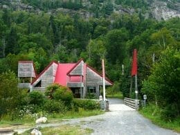
Located in the north of the Lanaudière region, in the municipality of Saint-Zénon to be precise, Parc Régional des Sept-Chutes offers some of the finest views of the Hautes Laurentides landscape. The park’s terrain is characterized by high hills, with an average altitude of 500 meters, and rocky escarpments. Mont Brassard reaches 650 metres and Mont Barrière 610 metres.
The Mont Brassard trail is a must if you want to admire the fall colors and take in the scenery! It winds its way along the top of the Lac Rémi cliff, offering breathtaking views of the lake and surrounding hills. With its rocky capes and belvederes, you’ll discover breathtaking northern landscapes!


User Reviews
Write a reviewBe the first to write a review.