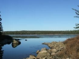
Located on the western edge of Lake Opasatica, this 5 km loop trail begins at the bridge over the lake.
It passes by a waterfall and uses the still-visible route of an old logging trail for the return trip.
The trail is marked and equipped for hiking in summer and cross-country skiing and snowshoeing in winter.
A shelter is set up at the start of the trail.
An extension of the trail to Lac Gingras is roughly marked.
Rollet
Contact information
GPS:
47.966767
-79.307556

Address:rue des Bouleaux, Rouyn-Noranda, Québec, Canada
Phone: 819-439-4141
Carte: gielz6g5hj

User Reviews
Write a reviewBe the first to write a review.