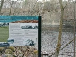
Developed by volunteers, the trail follows the winding course of the Rivière du Chêne, offering advantageous views of the cliffs of its clay canyon. White shells, vestiges of the Champlain Sea dating back nearly 10,000 years, are still encrusted on the trail. The 4.2 km trail winds through a forest of ash, hemlock, maple and century-old pine. The trail also features four interpretive panels on the fauna, flora and geological phenomena found on the site. The trail is accessible all year round, on foot or snowshoes, and includes a few technical climbs. Access is free of charge.
Access
The two access points with parking are at either end of the trail, on Route Marie-Victorin (Route 132) in Leclercville and Chemin du Vieux-Moulin in Lotbinière.
Note: The trail is closed during the big game hunting season in October and November.

User Reviews
Write a reviewBe the first to write a review.