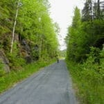
Watershed bicycle path
Description
This bike path links Rouyn-Noranda’s D’Alembert district to the municipality of Taschereau. The 56 km route is marked Route Verte #2. It follows an old railroad line and has a stone-dust surface. Cyclists will have access to a variety of landscapes representing typical Abitibi-Témiscamingue ecosystems.
Right from the start, the D’Alembert marsh welcomes you with its beavers and birdlife. The route passes through breathtaking agricultural landscapes and leads to the Parc de Cléricy, a perfect spot for a well-deserved break. The route then gives way to vast wetlands where beavers, ducks, snipe and herons live side by side. The route is dotted with bridges spanning rivers and streams, including the majestic Rivière Dufresnoy. Near Laferté, the Bailey Bridge crossing over the Lois River leaves no one indifferent!
Note: As of 2021, one section has been closed. Find out in advance if you plan to do the whole route.
Information
Telephone: 1-819-797-3195
Toll-free: 1-888-797-3195
E-mail: tourisme@cldrn.ca
Website: Tourisme Rouyn-Noranda
Map (pdf): Guide Cyclo-voie du partage des eaux


User Reviews
Write a reviewBe the first to write a review.